Network, Instrumental Improvements and Future Plans of the HartRAO Fiducial Station
Ludwig Combrinck
Hartebeesthoek Radio Astronomy Observatory
Hartebeesthoek, South Africa
June 14, WEGENER 2002, Athens-Greece
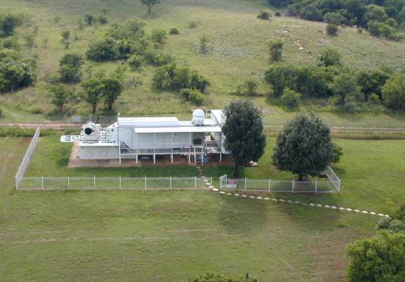
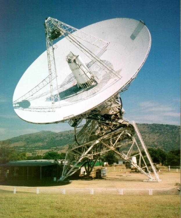
Figure 1. MOBLAS-6 at HartRAO.
Introduction
HartRAO is currently engaged in several projects which will enhance
space geodetic activities
in the southern region of the African continent. Our active role in
the major space geodesy
techniques (VLBI, SLR and GPS) are set to change from passive data
collection to include
active research and training. This will require transformation, capacity
building and new
approaches to meet these objectives.
Our involvement in the southern African region will include specific
targets and opportunities
which will elicit active and committed participation of the SADC countries,
with set objectives
such as capacity building, development of local expertise and projects
which will lead to
community upliftment and poverty alleviation through improved geodetic
capabilities. Africa
needs to move from old mapping co-ordinate systems to the latest international
standards in
order to develop frameworks for reliable geospatial information or
GIS systems. This is a
prerequisite for adequate land management, cross-border management
of drainage basins
and the integration of trans-national spatial information.
HartRAO is currently engaged in several projects which will enhance
space geodetic activities
in the southern region of the African continent.
Current and Proposed Projects
HartRAO, as a National Facility of the National Research Foundation(NRF) is:
- 1) Establishing a regional GPS network involving all the Southern African Development Community (SADC) countries, which will be part of the envisaged African Reference Frame (AFREF) network.
- 2) Establishing a Geodetic Institute at HartRAO.
- 3) Actively involved in the IGS TIGA pilot project.
- 4) Upgrading the Geodetic VLBI antenna to enhance VLBI capabilities.
- 5) Expanding the Space Geodesy Programme to ensure adequate capacity and capability.
- 6) Planning to increase SLR tracking time to optimize data output.
- 7) Planning to build an additional radio telescope, which will allow us to increase our participation in geodetic VLBI by a factor of 3.
- 8) Committed to participate in bidding for the proposed IAG Outreach Branch
SADC Regional GPS Network
The SADC consists of:
South Africa, Lesotho, Botswana, Mocambique, Swaziland, Zambia, Mauritius, Seychelles, Tanzania, Namibia, Zimbabwe, Angola, Democratic Republic of Congo (DRC) and Malawi.
The objectives of SADC include development and economic growth, promotion of self-sustaining development on the basis of collective self-reliance and to achieve complimentarity between national and regional strategies and programmes.
The ultimate objective is to build a region in which a high degree of harmonization and rationalization will enable pooling of resources to achieve collective self-reliance in order to improve the living standards of the people of the region.
The establishment of a regional (SADC) GPS network, as southern component is an integral part of the sustainable development programmes for the SADC region and supports the objectives of the New Partnership for Africa's Development (NEPAD) programme.
- ZAMB: in collaboration with NOAA and JPL (USA) was installed in Lusaka, Zambia, during March 2002.
- NAMI : (in collaboration with GFZ Potsdam, Germany) will be installed in Windhoek (Namibia) during the latter part of 2002.
- MAWI : (in collaboration with NRCAN, Canada) will be installed at Lilongwe in Malawi within the near future.
Geodetic Institute at HartRAO
Main objectives of the GI@HartRAO will be to:
- Facilitate research, education and applications of geodesy within the African continent via student exchanges, bursaries and post-doc programmes.
- Promote the objectives of the IAG services (especially IGS, IVS and ISLRS) and facilitate access to the products of these services.
- Participate actively in global geodetic projects.
- Aid the establishment of the African Reference Frame (AFREF) by installing a permanent network of GPS stations.
- Participate in the maintenance of AFREF as an AFREF analysis and Data Center.
- Act as a training center for space geodesy.
- Increase Africa's international role and participation in global geodesy.Build capacity and capability on the continent to ensure a contribution towards sustainable development.
IGS TIGA Pilot Project
The Space Geodesy Programme is involved in monitoring the positions
of tide gauges
in order to differentiate between long term sea-level changes and long
term crustal changes.
This is a global project which will aid and calibrate research data
used in global warming and global ocean level studies.
Main objectives of our participation in the TIGA
project are:
- Establish, maintain and expand a regional continuous GPS @ Tide Gauge network
- Function as a TIGA Associate Analysis Center (TAAC).
- Function as a TIGA Data Center.
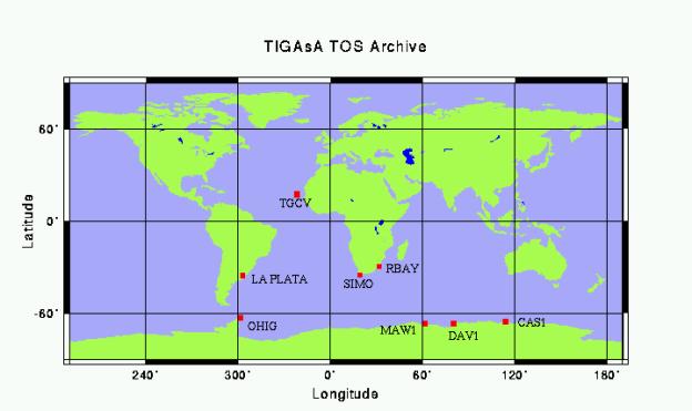
The Map (Figure 2) below depicts TIGA Observing Stations' (TOS)
data that are being archived by HartRAO for global access. More stations
will be added in due time.
Figure 2. TIGAsA TOS which are archived at HartRAO.
Radio Telescope Upgrades
- 1) Replacing hydraulic drive with an electric drive (completed).
- 2) Developing a new computer control and interface system based on the object oriented device control software TACO, developed and maintained by the European Synchrotron Radiation Facility (ESRF) in Grenoble, France (partially implemented).
- 4) Upgrading the antenna surface to solid panels of higher accuracy (nearly completed).
- 5) Upgrading the dichroic system which allows dual frequency operation.
These improvements will:
- 1) Extend useful life of 26m telescope.
- 2) Allow operation at up to 22GHz.
- 3) Improve efficiency at S band by a factor of 2.
- 4) Improve efficiency at X band by a factor of 1.5.
- 5) Improve signal to noise ratios.
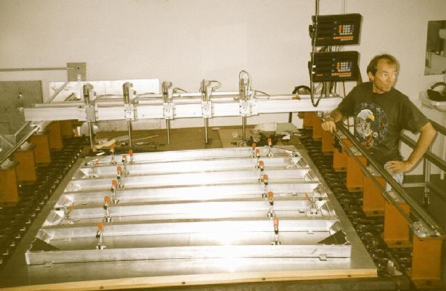
Figure 3. New panel on bed of bolts, glued on frame and formed by
vacuum.
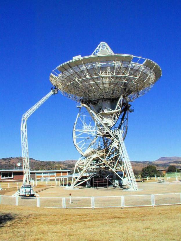
Figure 4. Installation of a new panel with the aid of a 'cherry
picker'.
Figure 5. The end in sight, only the inner ring needs to be completed.
Additional Radio Telescope
Proposed IAG Outreach Branch
The IAG outreach branch be part of the Geodetic Institute at HartRAO. Many objectives are similar or complimentary.
HartRAO would provide long term commitment, office facilities, supporting logistics as well as a real vested interest in the objectives of the Outreach Branch.
Develop membership, publish electronic newsletter. Promote the objectives of the IAG.
Be uniquely positioned to create resource base for educators, third world countries (most are in Africa anyway) and the global community.
Contact Information
HartRAO
PO Box 443
Krugersdorp
South Africa
Phone: +27 12 326 0742
Fax: +27 12 326 0756
E-Mail: ludwig@hartrao.ac.za