HartRAO Home >
news >
ntensive Campaign to study the Earth using Quasars 2002/10/16
Intensive Campaign to study the Earth using Quasars 2002/10/16
From 2002 October 16 to 31, the 26-m radio telescope at Hartebeesthoek will
form part of a global network of eight such telescopes that will study the
Earth continuously during that period.
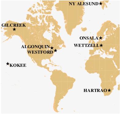
Location of the radio telescopes in experiment CONT02.
HartRAO as the only telescope in the network in the southern hemisphere.
Its participation has been made possible as the MKIII VLBI terminal was
recently upgraded to a MKIV, essential for this experiment. The long
north-south baselines from the northern telescopes to Hartebeesthoek are of
particular importance in improving the accuracy of the results in what is
essentially a process of triangulation on the quasars.
Photographs taken with the experiment in progress are at the end of
the text.
Why study the Earth?
The study of the Earth, its atmosphere and oceans, the solid ground beneath
us, on down to the fluid iron outer core and solid iron inner core, is
important for many reasons, ranging from the satisfaction of understanding
the world we live in to the practical applications of the tools used for the
observations. The better we understand "things", the better we can use them,
whether that means better weather forecasting or better navigation of
airliners, our private cars, or interplanetary spacecraft. All of these are
examples of spinoffs from systems that were developed for the scientific
study of the Earth's surface.
Using Space Geodesy to study the Earth
The three primary measurement systems for studying the shape of the Earth
use objects outside the atmosphere to provide the signal that is detected.
- Very Long Baseline Interferometry (VLBI) uses networks of radio
telescopes to receive the natural radio waves from quasars at the edge of
the universe. The quasars are so far away that their radio emission - from
jets shooting out from around massive black holes - appears almost point-like,
and they can be used like surveyor's beacons in the sky.
- The Global Positioning System (GPS) receives radio signals generated in
twenty-four satellites orbiting the Earth every twelve hours.
- A Satellite Laser Ranging (SLR) system reflects light pulses off
reflectors on satellites.
The three techniques are complementary in providing information about the
size, shape, and rotation of the Earth, but each has its own strengths in
terms of the specific property it can measure or in terms of the number of
locations that can be measured.
While all systems measure the shape of the Earth and the changing
locations on it due to plate tectonics or to earthquakes, VLBI is unique in
determining the absolute value of Earth's time and the direction of Earth's
axis of rotation relative the rest of the universe. SLR and GPS are used to
determine very precisely where each site is relative to the center of mass
of the Earth, and GPS systems are by far the most numerous, providing the
locations of thousands of sites around the globe with accuracy comparable to
VLBI, better than one centimeter uncertainty anywhere on the surface of the
Earth.
HartRAO is unique in the southern hemisphere in having all three systems
(VLBI, SLR, GPS) running together on the same site.
The CONT02 VLBI campaign
Over the next two weeks, October 16-31, an intensive campaign of continuous,
24 hours/day, measurements using VLBI, designated CONT02, will be conducted
using eight large radio antennas spanning the hemisphere from Svalbard,
Norway, at 79 degrees north to Johannesburg, South Africa, and from Europe
to Alaska and Hawaii. These antennas are supported by the governments of
seven different countries, all part of the International VLBI Service.
Outside of CONT02 measurements of 24-hour duration are conducted
approximately three times per week involving six to eight antennas at a time
selected from 30 antennas in 16 countries. While from a scientific and
applications point of view it is desirable to have continuous measurements
by all three techniques year-in and year-out, this is only possible, due to
budgetary constraints, for the GPS systems. The CONT02 campaign will provide
a set of VLBI data of the highest quality to study changes in the Earth's
properties on a timescale from a few days down to a few hours that cannot be
studied with the usual observation program.
The VLBI stations participating in CONT02 were selected on the basis of
their overall performance level, their ability to operate continuously for
15 days, and their geographic location. The location of each station is
important in determining the geometric strength of the network, where the
distances between the stations should be as large as possible and the
stations should be well distributed over the globe. It was also very
important that the station personnel wish to be involved in these important
scientific observations and are able to make the additional commitment
required to complete the extended program.
The participating stations will acquire data 24 hours per day for a total of
360 hours, beginning on October 16 and ending on October 31. The stations
operate under computer control, following a pre-determined schedule in which
the telescopes point at one quasar and acquire data for a time span of one
to several minutes, then quickly move to observe another quasar in a
different part of the sky, and so on. During the observing, different
sub-groups of the eight stations will observe sources simultaneously. The
network will acquire a total of about 54,000 individual observations made by
pairs of telescopes.
Science Goals
As might be expected of a system that uses radio waves from the distant
reaches of the universe as its signal, VLBI contributes to the study of many
phenomena, from the astronomical objects known as quasars, to General
Relativity, to meteorology, to the properties of the innermost parts of the
Earth.
While the applications of VLBI (for example climate monitoring and the
measurement of sea level change) will benefit most from the long-term
program, the objectives of the continuous campaign are driven primarily by
trying to improve our understanding of the excitation of the solid Earth by
the tides and currents in the atmosphere and the oceans, which in turn are
driven by the gravity of the Sun and Moon and by the heating of the Earth by
the Sun. The length of each day varies by micro-seconds, and over a week or
longer the accumulated changes are associated primarily with variations of
the winds. For example there is a strong correlation of length-of-day with
the effects of El Nino. A particular goal of CONT02 is to obtain better
measurements of changes in the Earth's rotation rate within a day and to
relate these changes to the tides of the oceans and to atmospheric winds.
Since VLBI also measures the effect of water vapor in the atmosphere on the
radio waves as they pass through it, an important result of the campaign
will be to provide data to improve the model for the effect of both the
water vapor and the dry part of the atmosphere. In the long term this will
help both the measurements of the changes in the shape of the Earth and the
products of the long term program used by the meteorologists.
Technology
The measurements by VLBI require the acquisition of very large amounts of
data from the quasars. Each antenna will record data at a rate of 256
million bits per second for approximately one-third of the time, giving a
total number of bits for the eight antennas in the fifteen days of
approximately one million billion. When recorded on the specialized high
performance tape recorders, developed in cooperation with industry, the
total length of tape for each station is about (5.5km/tape*2 tapes/day*15
days = ) 165 km.
A recent advance in the technology of VLBI is the development of disk
recording to replace the tape recorders. This will facilitate taking
advantage of the consumer market for computer disks to reduce the cost and
to improve the reliability of the recording systems. This has become
possible only because of the tremendous increase in disk storage capacity in
the last couple of years. This campaign will see the first operational use
of the new disk-based recording system. The record rate is equivalent to
filling a 40 gigabyte hard disk every fifty minutes.
All of the tapes and disks for one day must be shipped to one of three
locations for processing on custom designed digital correlators. These
correlators are located near Boston, Massachusetts; Washington, D. C.; and
Bonn, Germany. The results of the correlation are analyzed primarily at
seven universities and government facilities around the world, although many
other research institutions will analyze selected subsets of the VLBI data.
The next important improvement, which is in the initial stages of
development, will be the ability to transmit the recorded data from each
station to one of the correlators over high speed optical fibers, in much
the same way that the Internet is used today. Initial tests of such a system
have been conducted between antennas in Japan and the East Coast of the
United States with correlation in both countries.
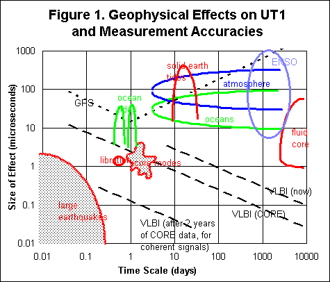
How accurate will the measurements be?
The precision expected for the UT1 measurements is about 2 microsec for the
CONT02 network. Length of day variations (more detail) are
computed as differences between daily measurements. Precision for station
position measurements are expected to be 1-3 mm in east and north, 4-8 mm in
height. We don't differentiate as to what effect causes what part of any
changes. Analysts plan to study day-to-day variations in the three
dimensional station positions to see if there are short-term effects.
Comparisons with the day-to-day GPS station positions will be made to study
any differences or offsets. Figure 1 indicates the geophysical effects on
UT1 and measurement accuracies. UT1 is the time of the earth clock,
determined astronomically, which has approximately 24 hours in a day. Length
of day (LOD), is the difference between TAI (atomic time scale) and UT1. On
January 1, 1958, UT1 equalled TAI. TAI is more stable than UT1, as the
instabilities of TAI are approximately 6 orders of magnitude smaller than
those of UT1.
How do the measurements compare to previous data?
The most precise measurements came from CONT94 which had truly continuous
sessions. The CONT96 campaign had measurements made on non-adjacent days
with the main goal being to measure frequency components of Earth
orientation. There are two main differences in CONT02:
- We are using a data rate that is higher by a factor of 4 compared to
CONT94, which means the formal errors should be better (smaller) by a factor
of 2.
- We are using a better geometric network mainly due to the inclusion of
HartRAO which will improve the polar motion precision; UT1 precision will be
about the same due to the same east-west network extent.
We expect that the results will get even better in the future as models are
refined and improved. This "retroactive improvement" is an important feature
of VLBI being able to re-analyze the entire data set when new insights, new
models, and new processing methods are developed. This is the basis for
attempting to acquire the best possible data today, anticipating that we
will be able to take advantage of scientific progress in the future.
How will the HartRAO SLR data be used?
The HartRAO/NASA satellite laser ranger will be operating during this
experiment to provide comparison data.
Analysts will compare the SLR baselines measured during the campaign, but
the most useful input will be for comparisons of the SLR reference frame
with the VLBA Terrestrial Reference Frame. Because SLR and VLBI have
complementary error sources, for example SLR is almost immune to water vapor
effects, the comparisons help to separate geophysical effects from
systematic errors.
How will the HartRAO GPS data be used?
The HartRAO/NASA Global Positioning System receiver operates continuously,
24 hours per day. HartRAO has similar GPS systems in Lusaka (Zambia),
Richardsbay, Sutherland and Simonstown. These GPS receivers are part of a
global tracking network (the International GPS Service, IGS), providing
continuous monitoring of station position as well as atmospheric and
ionospheric information. The results of the GPS data will be compared with
those of SLR and CONT02 to perform independent checks of the different
measuring techniques' performance.
Summary
Although the CONT02 program has as its primary goal the study of the Earth's
dynamics on relatively short time scales, the results will contribute to the
long-term objectives of the geodetic program. Among the more amazing and
curious features of the study of the properties of the Earth is that the
only means by which we currently are able to learn about the magnetic
properties of the Earth's core, where the magnetic field of the Earth is
most likely generated, is by using the VLBI technique to study signals from
the edge of the Universe to determine the variations in the direction of the
rotation axis over days, weeks, months, and years.
Links
Images
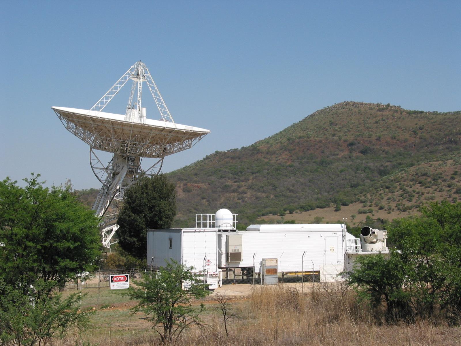
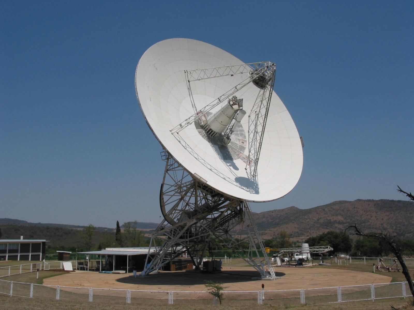
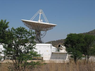
These images were taken at 0900 to 0915 on the morning of October 18. The
radio telescope was tracking the distant radio source 1124-186 (this exotic
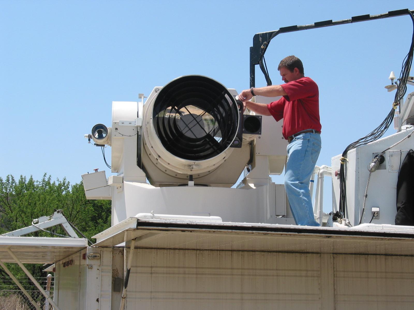
name refers to its position in the sky). The Satellite Laser Ranger (SLR)
was simultaneously tracking the satellite Lageos
1, several thousand kilometres distant in its orbit around the earth.
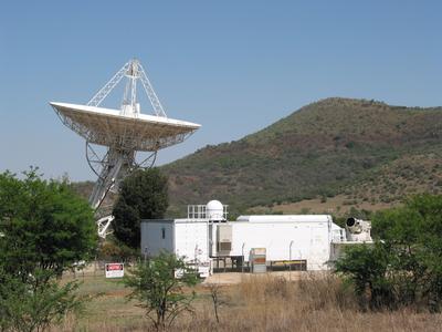
Radio Telescope and SLR.
Click on the picture for
the full size image.
The laser transmitter and telescope the receive the laser pulses back
from the satellite are on the far right of the van. The big black disk is
actually where light enters the telescope. the white "drum" is the body of
the telescope.
Radio Telescope and SLR.
Click on the picture for
the full size image.

Radio Telescope and SLR.
Click on the picture for
the full size image.
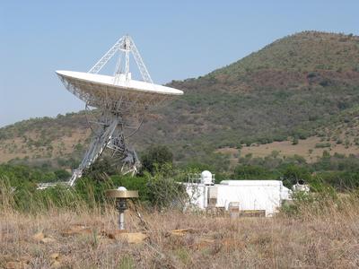
Radio Telescope, SLR and GPS basestation
antenna.
Click on the picture for the full size image.
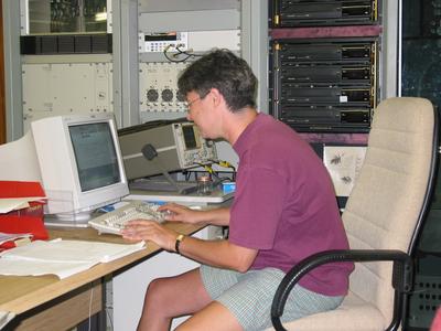
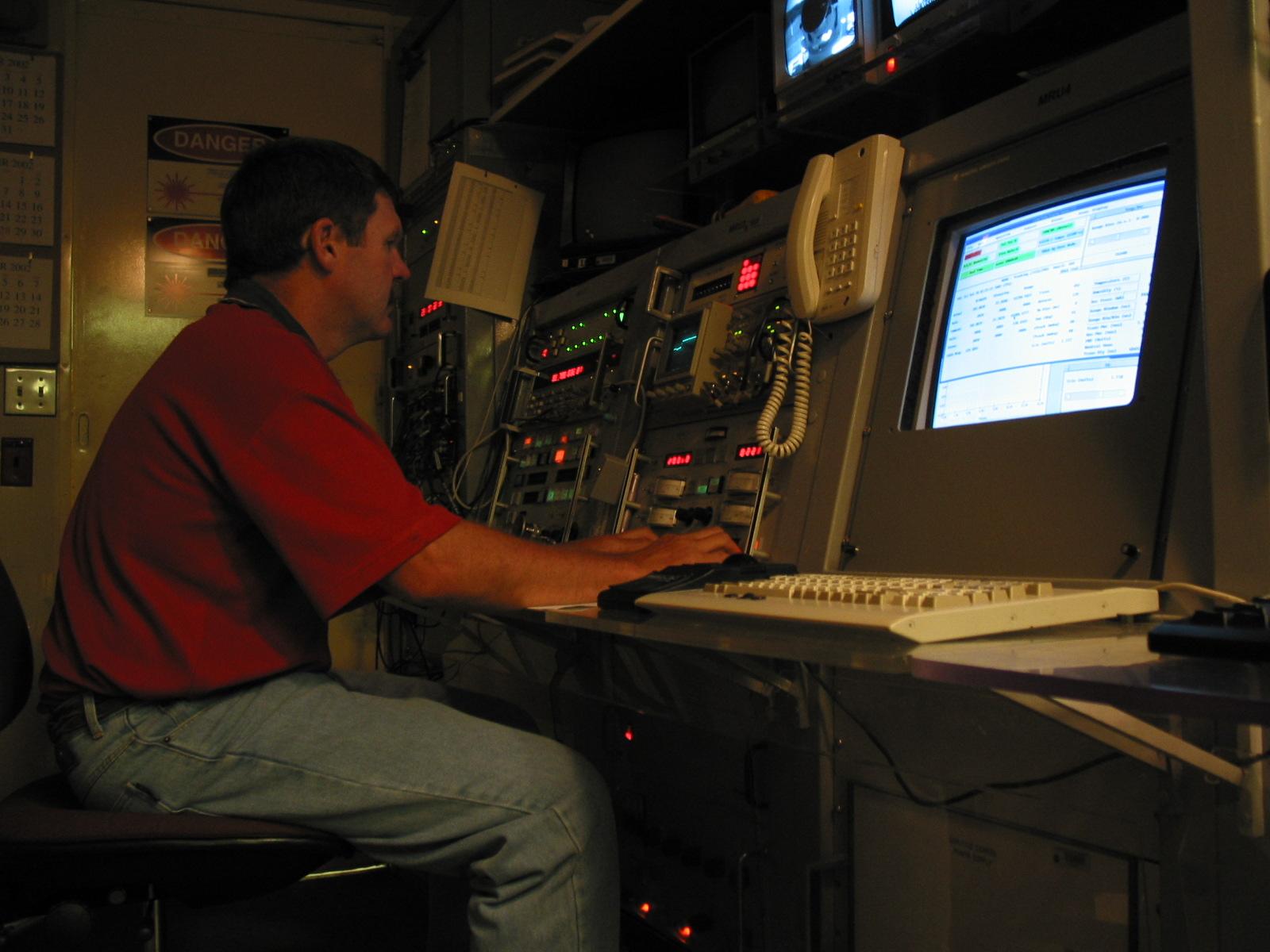
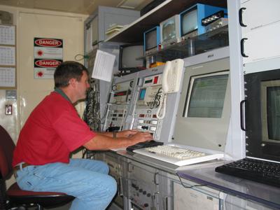
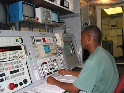
Marisa Nickola checks the VLBI schedule, as
the radio telescope tracks 1124-186 under computer control.
Click on the picture for the full size image.
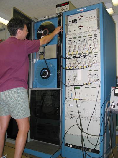
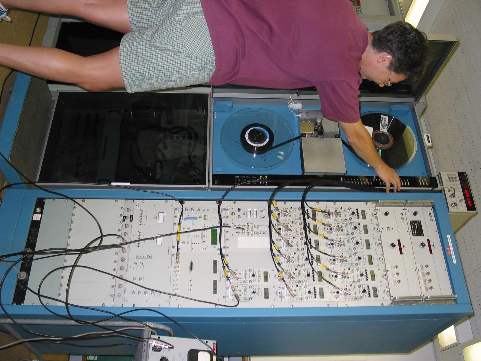
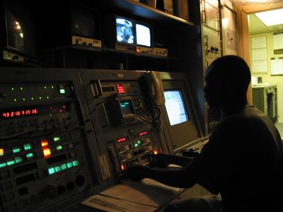
Marisa Nickola checks the tape
on the MK IV VLBI tape recorder.
Click on the picture for the full size image.
Wilhelm Haupt tracks the Lageos 1 satellite with the
SLR, seen here in a flash picture.
Click on the picture for the full size
image.

Wilhelm Haupt tracks the Lageos 1 satellite with the
SLR, seen here in the subdued light in which the operators work.
Click on
the picture for the full size image.

Close-up of the radio telescope.
Click on the picture for the full size image.
On top of the central conical structure are the two angled panels
("dichroic reflector") that split up the incoming radio waves so that they
can be recorded simultaneously at wavelengths of 13 cm (2300 MHz) and 3.5 cm
(8500 MHz), a critical part of this technique.
The 26m diameter main
surface of the telescope is being replaced, and this upgrade is largely
complete. The new panels are bright white. The few remaining old panels
near the centre appear grey.

Wilhelm Haupt re-adjusts the SLR after
calibration using a ground target.
Click on the picture for the full
size image.

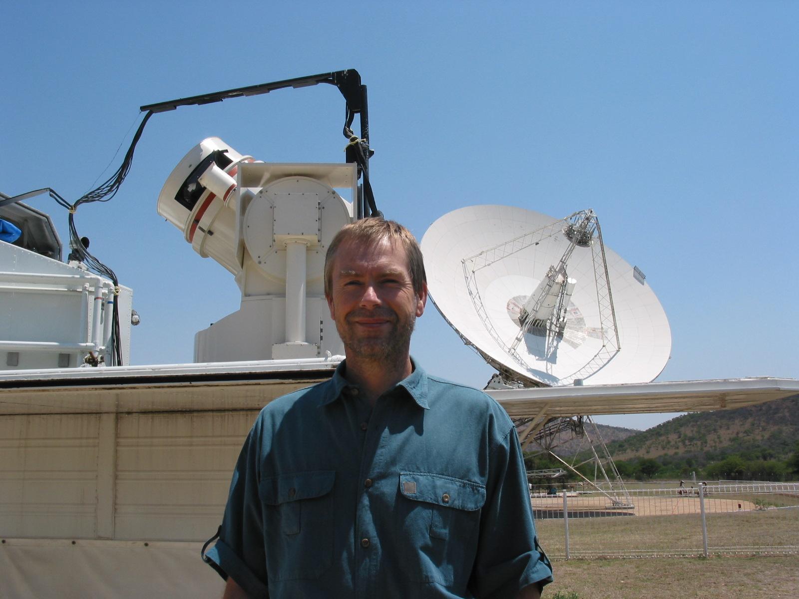
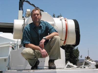
Space Geodesy Programme leader Dr. Ludwig
Combrinck in front of the SLR and radio telescope.
Click on the picture
for the full size image.

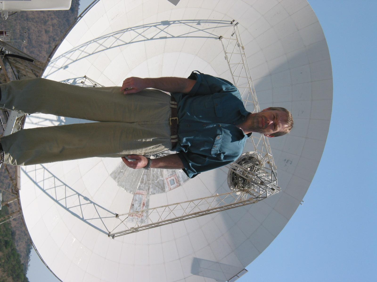
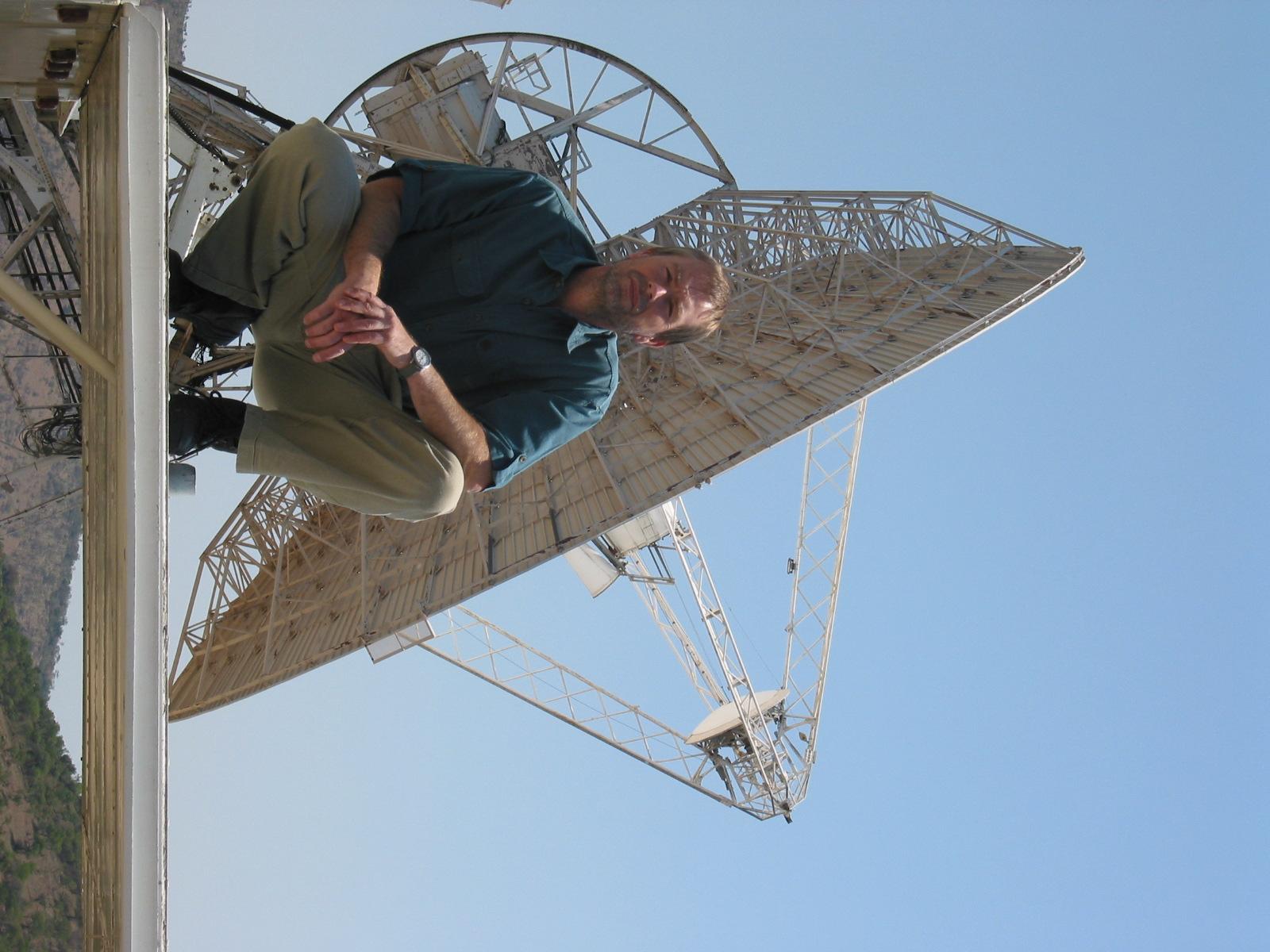
Space Geodesy Programme leader Dr. Ludwig
Combrinck in front of the radio telescope.
Click on the picture
for the full size image.
Space Geodesy Programme leader Dr. Ludwig
Combrinck in front of the SLR.
Click on the picture
for the full size image.

Space Geodesy Programme leader Dr. Ludwig
Combrinck in front of the radio telescope.
Click on the picture
for the full size image.
Flash photo of William Moralo tracking the
Lageos 1 satellite several thousand km away with the Satellite Laser Ranger
on the morning of Monday October 21. The oscilloscope with a blue screen in
front of William shows the return signal of the laser pulse as a "spike"
within the range gate.
Click on the picture for the full size
image.
Natural light photo of William Moralo tracking the
Lageos 1 satellite with the Satellite Laser Ranger on the morning of Monday
October 21. The weak return pulse of laser light is much easier to see in
low light conditions.
Click on the picture for the full size image.
Acknowledgements: Thanks to Arthur Niell (MIT, Haystack Observatory) and
Nancy Vandenberg (NASA) for providing information on CONT02.