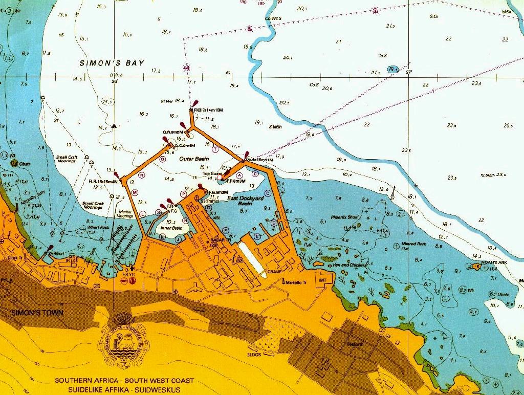
Tide gauge area map (portion of Simon's
Bay, SAN 1017)
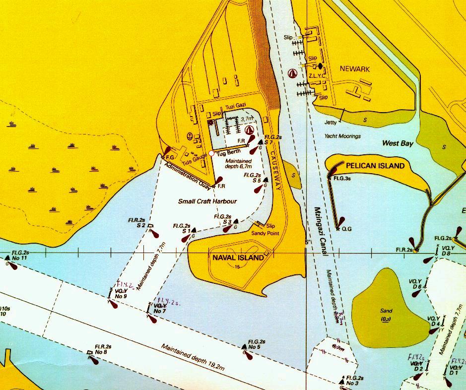
RBAY (Richardsbay)
Tide gauge area map (portion of Richards
Bay Harbour, SAN 1033)
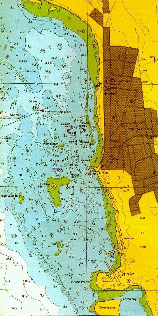
PNOL (Port Nolloth) : proposed station
Tide gauge area map (portion of Port Nolloth,
SAN 1003)
[SAN maps courtesy of the Hydrographer, SA Navy]
(Approximate position of tide gauges are indicated by red encircled
white circles)